© Photo by Shutterstock
The Best Hikes Along the California Coastal Trail
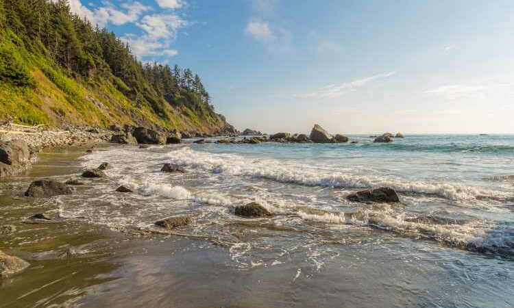
Photo by Shutterstock Hike the Redwood National and State Parks in Northern California, where the forest meets the sea.
Load Error
Last month, California’s Coastal Commission and Coastal Conservancy made exploring the diverse trails along the coast even more accessible by releasing a digital map of the existing sections of the California Coastal Trail—a network of paths that could eventually allow the public to traverse the entire length of California’s 1,230-mile-long coast. This collection of trails was first named in 1975 and is now approximately 70 percent complete, with 875 miles of opportunity for active treks along beaches, on bluff tops and hillsides, and via bicycle and paved paths.
Portions of the trail are accessible by foot, wheelchair, bicycle, and even horseback. According to Linda Locklin, the Coastal Access Program manager for the California Coastal Commission, due to some private property and geography restrictions, it could take decades for the segments to be fully completed, but there are already a number of opportunities to get out and enjoy the trails, which are even easier to navigate now with the digital map.
“Whether it’s the 26-mile long Bayshore Bikeway in San Diego, or just a one-mile stretch within an urbanized area that provides an off-road trail to get away from the city and enjoy some open space next to the ocean, each segment of the trail provides different amenities to different people,” says Locklin.
Here are a few options for setting off on an adventure on this ever-expanding coastal trail.
Redwood National and State Parks
Distance: 70 miles
Difficulty: Moderate
Known for the world’s tallest trees, Redwood National and State Parks in Northern California offer 70 miles of trails along Humboldt County’s “other Lost Coast,” which hikers can enjoy on a leisurely day jaunt or string together into a more challenging trek over several days. (Free permits are required for backcountry camping.) Along the trails, search for monkeyface eels in the tide pools, patrol a former World War II radar station that was disguised as a farmhouse, or explore the arrowhead-shaped monolith in the Ossagon Rocks. Watch whales, sharks, seals, and otters from the panoramic Klamath River overlook, sometimes all at once during seasonal salmon migrations. Search for semiprecious stones like quartz and witness North America’s largest Roosevelt elk on Gold Bluffs Beach and nearby Big Lagoon. And perhaps best of all, wander into Fern Canyon, a deep chasm draped with rare ferns and gentle waterfalls that was featured in Jurassic Park 2.
Tomales Point Trail
© Photo by Shutterstock
Hikers will have unobstructed Pacific Ocean views along segments of the Tomales Point Trail.
Photo by Shutterstock Hikers will have unobstructed Pacific Ocean views along segments of the Tomales Point Trail.
Distance: 9.4 miles
Difficulty: Moderate
Tomales Point Trail is a scenic out-and-back trail located at the northern end of Point Reyes National Seashore near the town of Marshall in Northern California. Hikers have the opportunity to view all kinds of wildlife, including Marin’s tule elk herd. Pierce Point Ranch gives visitors a chance to understand the early dairy ranching days on the peninsula, and the first three miles of the Tomales Point Trail follow the route of the old ranch road as it travels along the crest of the ridge. The trail, primarily used for hiking, walking, and running, is accessible year-round.
Boucher Trail Along Highway 1 Discovery Route
© Photo by Shutterstock
Walk to the Piedras Blancas lighthouse on the Central Coast’s Boucher Trail.
Photo by Shutterstock Walk to the Piedras Blancas lighthouse on the Central Coast’s Boucher Trail.
Distance: 3.8 miles round trip
Difficulty: Easy
As home to the largest northern elephant seal rookery in the mainland U.S., this secluded trail (located in San Simeon, California, just north of San Luis Obispo) offers intimate views of the elephant seals in their natural beach environment. Midway along the trail sits the Piedras Blancas Light Station, built in 1875 and still operating today. The lighthouse provides a glimpse into the maritime history and heritage of this part of the Central Coast.
Torrey Pines State Natural Reserve
Distance: Varies by trail (find trail distances here)
Difficulty: Easy to moderate
This 2,000-acre natural reserve in San Diego includes several miles of beaches, lagoons, canyons, and sandstone bluffs decorated with the Torrey pine—a rare pine tree that grows in only two places in California, here and the Channel Islands. The Guy Fleming Trail is an easy, 0.7-mile loop with scenic ocean views from two overlook points. From the North Overlook, you can see the Torrey pines up close and view the Peñasquitos Marsh, while the South Overlook offers views of the cities of La Jolla to the south, San Clemente to the north and visibility sometimes as far out to sea as the Santa Catalina Islands. In the winter, you might catch views of gray whales migrating along the coast.
>> Next: California’s Best National Parks and Monuments
Source: Read Full Article

